
N.I. Tongariro N.P. & Mt. Tauhara summit
S.I. Wide distribution. except Canterbury Plains & Banks Peninsula.
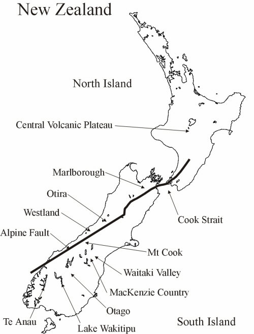
On this page: M.campbelli Biogeography; Phylogenetic trees for M. campbelli populations (MP, ML & ME); M. campbelli localities.


|
ID |
Location |
Actual Location |
Notes |
|---|---|---|---|
|
0 |
Henry Creek |
Henrys Creek, Eglinton Valley, Fiordland |
|
|
1 |
Boundary Creek |
Boundary Creek, Eglinton Valley, Fiordland |
|
|
2 |
Invincible Mine |
Invincible Mine, Rees River, Otago |
North of Lake Wakitipu |
|
3 |
Mount Nox |
Dart Valley, Barrier Range |
Mount Aspiring National Park, Otago (George Gibbs) |
|
4 |
Mount Creighton |
South of Airstrip, Lake Wakitipu |
Need to look in field notes. |
|
5 |
Wedge Peak |
Twelve-Mile Delta, Lake Wakatipu |
12 miles west south west of Queenstown. |
|
6 |
Glendhu Bay |
Need to check in field notes. |
Near Glendhu Bay? NW of Wanaka. |
|
7 |
Albert Town |
Albert Town |
Lake Wanaka. Just N of the Clutha River |
|
8 |
Remarkables Ski Field |
Rastus Burn Ski Road |
|
|
9 |
Lindis Pass |
Lindis Pass |
Along HWY 8 at rest stop on West side of road. |
|
10 |
Sebastopol |
Birch Stream |
Mount Cook National Park. Birch Stream along trail to Mount Sebastopol |
|
11 |
Lake Ohau Lodge |
Lake Ohau Ski Field Road |
|
|
12 |
Ahuriri River |
Ahuriri River Bed |
Along dirt road near where long slip creek hits the Ahuriri River NW of HWY 8. |
|
13 |
Omarama |
Little Omarama River |
MacKenzie Country. On a private Farm Road. |
|
14 |
Boundary Stream |
Boundary Stream |
In the bed of Boundary Stream along gravel road on the eastern shore of Lake Tekapo. |
|
15 |
East Branch Awakino River |
Awakino River |
Where Awakino River Crosses Awakino Ski Field Road West South West of Kurow. |
|
16 |
Kye Burn |
Kye Burn River |
In Kye Burn River bed between Dansey's Pass and Kye Burn. Not Far from Kye Burn Diggings. |
|
17 |
Obelisk |
Old Man Range |
Symes Road |
|
18 |
Arthurs Pass |
Arthurs Pass, Westland |
Arthurs Pass National Park. |
|
19 |
Porters Pass |
Porters Pass, Peg Leg Creek |
|
|
20 |
Hurunui River South Branch |
South Branch Hurunui River |
Collected by George Gibbs |
|
21 |
Lake Tennyson |
Lake Tennyson, Marlborough |
On the St. Arnaud-Hamner Road |
|
22 |
Lewis Pass |
Lewis Pass, Canterbury |
St. James Walkway |
|
23 |
Mount Kakapo |
Waiau River, West of Glen Wye |
Along HWY 7 in Waiau River bed. |
|
24 |
Glenhope |
East of Glen Wye, Waiau River |
Along HWY 7 in Waiau River bed. |
|
25 |
No Catchem Stream |
No Catchem Stream |
Along St. Arnaud-Hamner Road. |
|
26 |
Lake Sedgemere |
Lake Sedgemere |
Along the St. Arnaud-Hamner Road |
|
27 |
Mason Hills |
Mason Hills HSTD |
HW 70 In Wandle River bed, Canterbury |
|
28 |
Oaro |
Oaro River |
Along HW 1 SW of Oaro |
|
29 |
Iwikau Village |
Mount Ruapehu |
On the Bruce Road, below Iwikau Village |
|
30 |
Pine Valley Stream |
Pine Valley Stream |
Along Wairau River Road North shore of Wairau River in Pine Valley Stream bed. |
|
31 |
Haast Pass/Tioripatea |
Haast pass |
Mount Aspiring National Park |
|
ID |
Location |
||
|---|---|---|---|
|
0 |
Homer Tunnel |
||
|
1 |
Milford Sound |
||
|
2 |
Lake Monowai |
||
|
3 |
McKerrow Island Hut |
||
|
4 |
Eglinton River |
||
|
5 |
Mararoa River |
||
|
6 |
Te Anau |
||
|
7 |
Manapouri Aerodrome |
||
|
8 |
Worsley Arm |
||
|
9 |
Lake Wakatipu |
||
|
10 |
Glenorchy |
||
|
11 |
Ben Lomond |
||
|
12 |
EYRE MOUNTAINS |
||
|
13 |
Oreti Rievr |
||
|
14 |
Makarora |
||
|
15 |
Lake Hawea |
||
|
16 |
Cardrona River |
||
|
17 |
Arrowtown |
||
|
18 |
Karangarua River |
||
|
19 |
Waiho River |
||
|
20 |
Lake Paringa |
||
|
21 |
Ahuriri River |
||
|
22 |
Kidds Bush |
||
|
23 |
Titan Bluff |
||
|
24 |
Black Birch Stream |
||
|
25 |
The Hermitage |
||
|
26 |
Kea Point Track |
||
|
27 |
Mount Wakefield |
||
|
28 |
MOUNT COOK RANGE |
||
|
29 |
SEALY RANGE |
||
|
30 |
Tasman Glacier |
||
|
31 |
Lake Pukaki |
||
|
32 |
Boundary Stream |
||
|
33 |
Tekapo River |
||
|
34 |
Washdyke Stream |
||
|
35 |
Mackenzie River |
||
|
36 |
GRAMPIAN MOUNTAINS |
||
|
37 |
Deep Stream |
||
|
38 |
Danseys Pass |
||
|
39 |
Kyeburn |
||
|
40 |
Potts River |
||
|
41 |
Clyde River |
||
|
42 |
Tank Gully |
||
|
43 |
Ashburton Gorge |
||
|
44 |
Pareora River |
||
|
45 |
Waimakariri River |
||
|
46 |
Bealey River |
||
|
47 |
Otira |
||
|
48 |
Barrack Creek |
||
|
49 |
Mount Algidus |
||
|
50 |
CRAIGIEBURN RANGE |
||
|
51 |
Castle Hill |
||
|
52 |
GREY RANGE |
||
|
53 |
Cass |
||
|
54 |
MOUNT HUTT RANGE |
||
|
55 |
Glenrock |
||
|
56 |
Porters Pass |
||
|
57 |
Mount Somers |
||
|
58 |
Rangitata |
||
|
59 |
Thompson Stream |
||
|
60 |
Lake Taylor |
||
|
61 |
Lake Sarah |
||
|
62 |
Kowai River |
||
|
63 |
Sabine River |
||
|
64 |
Clarence River |
||
|
65 |
Waiau River |
||
|
66 |
Travers River |
||
|
67 |
Rainbow Pass |
||
|
68 |
Lewis River |
||
|
69 |
Lewis Pass |
||
|
70 |
Manuka Creek |
||
|
71 |
The Forks |
||
|
72 |
Grey River |
||
|
73 |
Lake Rotoiti |
||
|
74 |
Motupiko River |
||
|
75 |
Wairau River |
||
|
76 |
Lake Sedgemere |
||
|
77 |
Awatere River |
||
|
78 |
Saint James |
||
|
79 |
Cave Creek |
||
|
80 |
Hurunui |
||
|
81 |
Waipara |
||
|
82 |
Hodder River |
||
|
83 |
Winterton River |
||
|
84 |
Totara Stream |
||
|
85 |
Oaro River |
||
|
86 |
Puhi Puhi River |
||
|
87 |
Kaikoura |
||
|
88 |
Clarence |
||
|
89 |
Sherry River |
||
|
90 |
Donald Creek |
||
|
91 |
Hope Saddle |
||
|
92 |
Kaka |
||
|
93 |
Wainui Saddle |
||
|
94 |
Tapawera |
||
|
95 |
SPOONERS RANGE |
||
|
96 |
Maitai River |
||
|
97 |
NELSON |
||
|
98 |
French Pass (Anaru) |
||
|
99 |
Wairau Diversion |
||
|
100 |
Mackenzie Pass/Manahuna |
||
|
101 |
Haast Pass/Tioripatea |
||